Saturday, April 27, 2013

Northeast Shelf-Water


Sea Surface Temperatures Reach Highest Level in 150 Years On Northeast Continental Shelf

Apr. 26, 2013 — Sea surface temperatures in the Northeast Shelf Large Marine Ecosystem during 2012 were the highest recorded in 150 years, according to the latest Ecosystem Advisory issued by NOAA's Northeast Fisheries Science Center (NEFSC). These high sea surface temperatures (SSTs) are the latest in a trend of above average temperature seen during the spring and summer seasons, and part of a pattern of elevated temperatures occurring in the Northwest Atlantic, but not seen elsewhere in the ocean basin over the past century.
The advisory reports on conditions in the second half of 2012.
Sea surface temperature for the Northeast Shelf Ecosystem reached a record high of 14 degrees Celsius (57.2°F) in 2012, exceeding the previous record high in 1951. Average SST has typically been lower than 12.4 C (54.3 F) over the past three decades.
Sea surface temperature in the region is based on both contemporary satellite remote-sensing data and long-term ship-board measurements, with historical SST conditions based on ship-board measurements dating back to 1854. The temperature increase in 2012 was the highest jump in temperature seen in the time series and one of only five times temperature has changed by more than 1 C (1.8 F).
The Northeast Shelf's warm water thermal habitat was also at a record high level during 2012, while cold water habitat was at a record low level. Early winter mixing of the water column went to extreme depths, which will impact the spring 2013 plankton bloom. Mixing redistributes nutrients and affects stratification of the water column as the bloom develops.
Temperature is also affecting distributions of fish and shellfish on the Northeast Shelf. The advisory provides data on changes in distribution, or shifts in the center of the population, of seven key fishery species over time. The four southern species -- black sea bass, summer flounder, longfin squid and butterfish -- all showed a northeastward or upshelf shift. American lobster has shifted upshelf over time but at a slower rate than the southern species. Atlantic cod and haddock have shifted downshelf."
"Many factors are involved in these shifts, including temperature, population size, and the distributions of both prey and predators," said Jon Hare, a scientist in the NEFSC's Oceanography Branch. A number of recent studies have documented changing distributions of fish and shellfish, further supporting NEFSC work reported in 2009 that found about half of the 36 fish stocks studied in the Northwest Atlantic Ocean, many of them commercially valuable species, have been shifting northward over the past four decades.
The Northeast U.S. Continental Shelf Large Marine Ecosystem (LME) extends from the Gulf of Maine to Cape Hatteras, North Carolina. The NEFSC has monitored this ecosystem with comprehensive sampling programs since1977. Prior to 1977, this ecosystem was monitored by the NEFSC through a series of separate, coordinated programs dating back decades.
Warming conditions on the Northeast Shelf in the spring of 2012 continued into September, with the most consistent warming conditions seen in the Gulf of Maine and on Georges Bank. Temperatures cooled by October and were below average in the Middle Atlantic Bight in November, perhaps due to Superstorm Sandy, but had returned to above average conditions by December.
"Changes in ocean temperatures and the timing and strength of spring and fall plankton blooms could affect the biological clocks of many marine species, which spawn at specific times of the year based on environmental cues like water temperature," Kevin Friedland, a scientist in the NEFSC Ecosystem Assessment Program, said. He noted that the contrast between years with, and without, a fall bloom is emerging as an important driver of the shelf's ecology. "The size of the spring plankton bloom was so large that the annual chlorophyll concentration remained high in 2012 despite low fall activity. These changes will have a profound impact throughout the ecosystem."
Michael Fogarty, who heads the Ecosystem Assessment Program, says the abundance of fish and shellfish is controlled by a complex set of factors, and that increasing temperatures in the ecosystem make it essential to monitor the distribution of many species, some of them migratory and others not.
"It isn't always easy to understand the big picture when you are looking at one specific part of it at one specific point in time," Fogarty said, a comparison similar to not seeing the forest when looking at a single tree in it. "We now have information on the ecosystem from a variety of sources collected over a long period of time, and are adding more data to clarify specific details. The data clearly show a relationship between all of these factors."
"What these latest findings mean for the Northeast Shelf ecosystem and its marine life is unknown," Fogarty said. "What is known is that the ecosystem is changing, and we need to continue monitoring and adapting to these changes."
Ecosystem advisories have been issued twice a year by the NEFSC's Ecosystem Assessment Program since 2006 as a way to routinely summarize overall conditions in the region. The reports show the effects of changing coastal and ocean temperatures on fisheries from Cape Hatteras to the Canadian border. The advisories provide a snapshot of the ecosystem for the fishery management councils and also a broad range of stakeholders from fishermen to researchers.
Share this story on FacebookTwitter, and Google:
Other social bookmarking and sharing tools:

Story Source:
The above story is reprinted from materials provided byNOAA Fisheries Northeast Fisheries Science Center.
Note: Materials may be edited for content and length. For further information, please contact the source cited above.

 APA

 MLA
NOAA Fisheries Northeast Fisheries Science Center (2013, April 26). Sea surface temperatures reach highest level in 150 years on Northeast continental shelf. ScienceDaily. Retrieved April 27, 2013, from http://www.sciencedaily.com­/releases/2013/04/130426115614.htm
Note: If no author is given, the source is cited instead.
Disclaimer: Views expressed in this article do not necessarily reflect those of ScienceDaily or its staff.

Saturday, April 20, 2013

Baleen Whale Evolution - Climate Driven?


Check out the timely article below (courtesy of New Scientist) on some baleen whale developments in the Southern Hemisphere.


Antarctic freeze paved the way for baleen whales

Antarctica's icy blanket and huge, filter-feeding whales may be inextricably linked. It seems that when the South Pole first froze over, the expanding ice sheets may have completely transformed ecosystems in the surrounding oceans, even driving the evolution of baleen whales.
Up until around 34 million years ago, Antarctica was warm and lushly forested. Then, within just 200,000 years, glaciers formed and spread over the entire continent creating a vast frozen wasteland.
Sander Houben of Utrecht University and the Netherlands Organisation for Applied Scientific Research and his colleagues studied tiny fossilised organisms in sediment cores from the Antarctic seabed to find out how these changes on the continent changed the surrounding marine life.
Houben focused on single-celled organisms called dinoflagellates, which produce hard cysts that often fossilise. Before the ice emerged, the dinoflagellates were a mixed bunch – some species produced their own energy by photosynthesis, others fed on smaller organisms.
But as soon as the ice began to spread, photosynthesising dinoflagellates disappeared, leaving only the predators. The same setup exists today: dinoflagellates survive solely by feeding on other types of photosynthesising algae. "There is a black to white transition towards the modern-day state," says Houben.

Shifting ice

Houben thinks sea ice was key. Nowadays, Antarctica is fringed by floating sheets of ice that grow in winter and shrink in summer. This means plankton can only thrive during a very narrow seasonal window, says Houben.
In summer, melting sea ice releases nutrients into the water. Combined with lengthening days, this triggers vast plankton blooms. The blooms are set upon by swarms of Antarctic krill, which in turn are eaten by many larger animals including baleen whales.
Houben thinks that the switch from year-round life to seasonal blooms, driven by expanding sea ice, forced the ecosystem to adapt. Dinoflagellates would not have been able to make a living by photosynthesising in the cold and dark winter conditions under the sea ice, but could thrive by eating the annual plankton blooms.
The consequences may have been felt far beyond the sea ice zone. A 2009 genetic study by Eske Willerslev of the University of Copenhagen in Denmark found that baleen whales split from toothed whales around 36 million years ago (Systematic Biology, DOI: 10.1093/sysbio/syp060). That is suspiciously close to the onset of the Antarctic freeze.
Baleen whales feed by lunging into swarms of krill. They filter the seawater and trap the tiny krill using the sheets of baleen that line their mouths. Houben speculates that the shift to seasonal krill blooms may have driven their evolution. Filter feeding would have allowed them to take full advantage of the annual krill blooms.

Monday, April 8, 2013

Disappearing Land

Satellite views of Louisiana's wetlands before and after Hurricane Katrina

Remember Chapter 10 and depositional shorelines? And subsidence? Well, Louisiana has both.  Combine them with sea level rise and you have a perfect recipe for current and future problems.  The link below will take you to a NOAA article on coastal Louisiana's literal disappearance beneath the waters of the Gulf of Mexico.

The image above is from U. Texas, and is showing the same hard reality.

NOAA Article - Land Loss in Louisiana

Saturday, April 6, 2013

A River Delta's Revival?


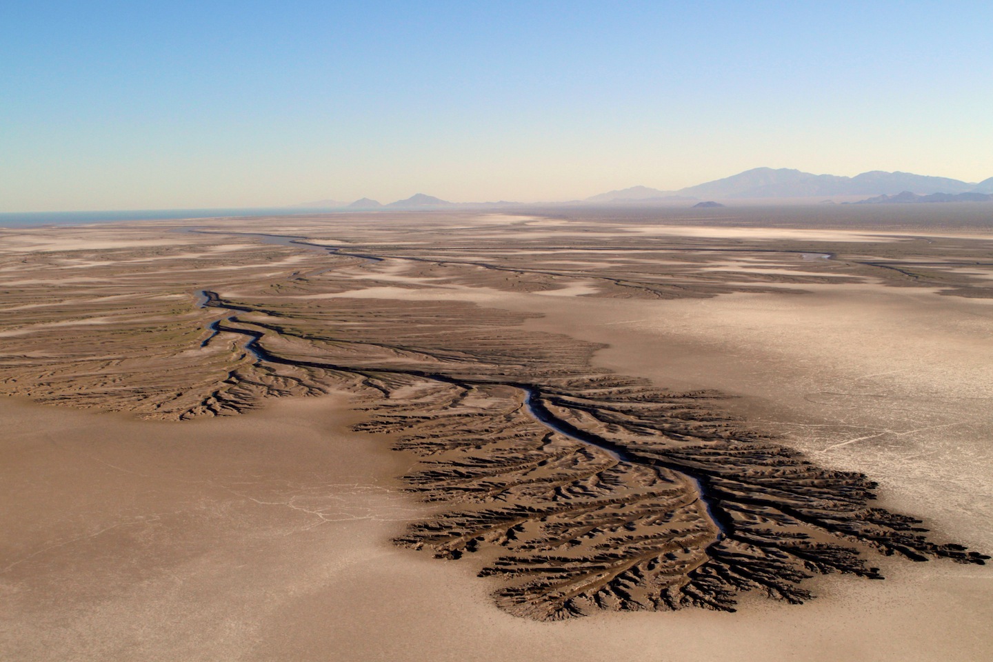
If you remember, we learned about river deltas earlier this year.  We said at the time that deltas are depositional features that can form in low wave energy environments.  Deltas can be severely impacted by human activities and we cited two examples: The Mississippi and Nile Deltas.  Well, an historic agreement has been signed recently by the United States, Mexico, and a number of conservation groups to provide water flow to the Colorado River's Delta in the Gulf of California.

Read on for more...


Landmark Cooperation Brings the Colorado River Home

In most years, little water makes it past Morelos Dam just south of the U.S.-Mexico border, which leaves the Colorado River and its delta dry. Photo by Cheryl Zook/National Geographic
This post is part of a series on the Colorado River Delta.
Standing at Morelos Dam, the last in the long line of dams on the Colorado River, and the only one in Mexico, it’s hard not to feel that we humans have betrayed this great river.
It has traveled 1,350 miles from its headwaters, shared its flow with Los Angeles and Las Vegas, Phoenix, Tucson, and Denver.  It has watered field upon field of tomatoes, melons, alfalfa and cotton.  When it arrives here, it is largely spent:  In a typical year, ninety percent of its flow is gone by the time it reaches the U.S.-Mexico border.
As Morelos diverts the remaining ten percent into a canal for delivery to the residents of Mexicali and the farmers of the Mexicali Valley, the heaviness of death takes hold.  From atop the dam, I look south – and see the river is gone.
The Colorado has not reached its lower delta and estuary for most of the last half century.  As giant Lake Powell filled after the completion of Glen Canyon Dam in 1963, virtually no flow passed Morelos Dam for eighteen years straight.  Only El NiƱo events, which brought heavy precipitation to the basin in the early 1980s and again several times during the 1990s, gave the Colorado the satisfaction of a run to the sea.
But thanks to a remarkable effort of bi-national scientific and political cooperation, the Colorado will once again wind though its delta, nourish native trees along its banks, rejuvenate nursery grounds in its estuary, and greet the salty tides of the upper Gulf of California with its precious sweet water.
historic agreement signed on November 20, 2012, commits both the United States and Mexico to deliver flow back to the Colorado Delta.
Known as Minute 319, an addendum to the 1944 treaty that defines how the United States and Mexico share the Colorado River, the agreement calls for a five-year pilot program to provide a total of 158,088 acre-feet (195 million cubic meters) of water to the lower river and its delta.
That’s about one percent of the river’s historic annual flow delivered over five years.
Although not a great deal of water, conservation groups on both sides of the border have worked tirelessly for more than a decade to create a “map of the possible” that prioritizes restoration opportunities that can be achieved with additional water.
“There’s a lot of hope that through Minute 319 we will achieve meaningful restoration,” saidOsvel Hinojosa Huerta, a National Geographic Emerging Explorer and Director of the Water and Wetlands Program for Pronatura Noroeste, the regional chapter of Pronatura, Mexico’s largest conservation organization. “Minute 319 is a landmark for the restoration of the delta.”
A Shared Commitment
Two thirds of the water committed to the delta will be used to create a “pulse flow” – a slug of water that mimics the natural yearly flood that historically occurred as the Rocky Mountain snows melted and filled the river’s channel.  A periodic pulse flow is essential to scour the channel and floodplain, thwart the growth of salt cedar, and help establish willows and cottonwoods, which require flooding for seed germination.
The other third of the Minute 319 water will create a “base flow’’ that keeps the river corridor wet and flowing.
In a unique alliance, the Mexican and U.S. governments and a coalition of conservation organizations are each responsible for delivering a third of the total water committed to the delta under the agreement.
To fulfill its share, the conservation groups are buying water rights from willing sellers in the Mexicali Valley and banking them in the Colorado River Delta Water Trust – the first water bank in Mexico dedicated to returning water to the environment.
Besides providing flows to the delta, Minute 319 sets out a new formula for sharing the gain from times of surplus as well as the pain of drought. The latter is particularly important since climate scientists expect dry spells to occur more frequently in the Colorado Basin in the coming decades.
Minute 319 also gives Mexico the ability to store water in Lake Mead, the vast reservoir behind Hoover Dam, giving both nations additional flexibility in how they manage the river’s flows.
“Leaving behind unilateralism, the two countries united to sign the most important bilateral Colorado River agreement since the 1944 Treaty,” writes Jennifer Pitt, Colorado River Project Director for the Environmental Defense Fund.  Minute 319 provides for “exactly the kind of innovations that will be needed for both the river and the communities who use it to weather the impacts of climate change.”
The Colorado River approaches the U.S.-Mexico border. Here at Morelos Dam, most of the remaining ten percent of the river's flow is diverted to the Mexicali Valley.
The Colorado River approaches the U.S.-Mexico border. Here at Morelos Dam, most of the remaining ten percent of the river’s flow is diverted to the Mexicali Valley.
This cooperation, which was hard won, not only binds the two nations more tightly together, it opens the door to more creative solutions for managing the limited waters of the Colorado.
“The increased levels of binational cooperation and management flexibility offered by this agreement may well be critical to the future of the region,” said Peter W. Culp, a partner with the law firm Squire Sanders, in an email exchange.  Culp represented the interests of U.S. conservation organizations and assisted U.S. officials during the negotiations.
At the historic signing ceremony for Minute 319 in San Diego, California, U.S. Secretary of the Interior Ken Salazar struck a chord for cross-border and cross-cultural conciliation over river matters into the future.
“We are connected truly as two peoples by our reliance on the Colorado River,” Salazar said. “In fact the Colorado River in so many ways makes us one people.”
A New Day, but Hard Work Remains
The ink was barely dry on the new agreement when the conservation groups so instrumental in bringing this historic agreement to fruition began to plan to ensure its success.  Assuming the flows and restoration projects are producing good results, the bi-national activities would be extended  – and hopefully expanded — through 2026.
While Minute 319 provides a crucial start to revitalizing the Delta, research by Edward P. Glenn at the University of Arizona and others suggests that allocating about one percent of the Colorado River’s historic flow to the river every year (rather than over five years, as Minute 319 does) – and delivering an annual base flow of 30,000-50,000 acre-feet and a periodic pulse flow of about 260,000 acre-feet – are needed to sustain the delta ecosystem over the long term.
Though a humble name, Minute 319 is a grand achievement in international river cooperation: two countries and their conservation communities have come together to give some water back to a long-contested and over-allocated river.
And for the insects and birds and people, trees and fish of the Colorado Delta, it heralds a new day: their river is finally coming home.
Sandra Postel is director of the Global Water Policy Project and Freshwater Fellow of the National Geographic Society. She is the author of several acclaimed books, including the award-winning Last Oasis, a Pew Scholar in Conservation and the Environment, and one of the “Scientific American 50.” She is co-creator of Change the Course, the national freshwater conservation and restoration campaign being piloted in the Colorado River Basin.
Special thanks to Silk, the Charter Sponsor for Change the Course. Additional funding generously provided by the Walton Family Foundation.

Monday, April 1, 2013

Polar Bears - How Much Longer?


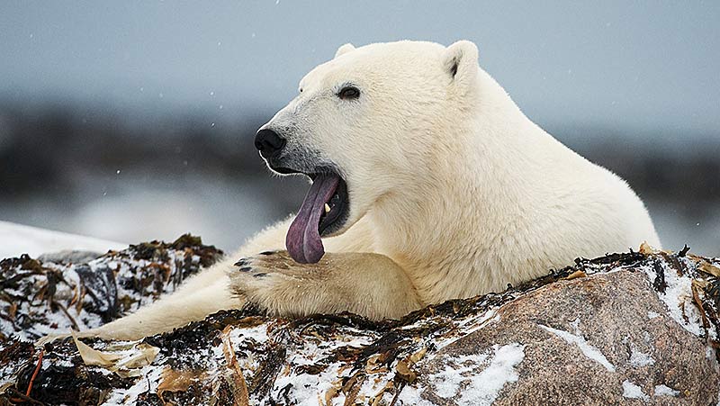
With the changes afoot in the Arctic, who knows how much longer polar bears will be able to survive, let along thrive.  Their hunting grounds are literally melting beneath their feet.

Check out the BBC Nature slideshow at the following link.
BBC Nature - Polar Bears